Simply beautiful. We are officially spoiled, Middle Tennessee. Every single morning has been spectacular — rain-free low humidity and isolated areas of patchy fog.
Our days of upper 80s come to an end…today! So if you’re a fan, soak it up! 
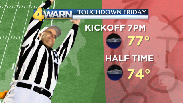
Weather will be perfect for Touchdown Friday football tonight. Expect a few clouds and warm upper 70s around kickoff at 7pm. No need to bring along the rain gear.
Dew points are comfortably low which means humidity holds off…just for one more day.
Moisture from what is now Tropical Storm Nate will amp up humidity with increasing moisture and cloud cover on Saturday. This will aid in sparking afternoon isolated storms but the better chance for rain and storms arrives late at night.
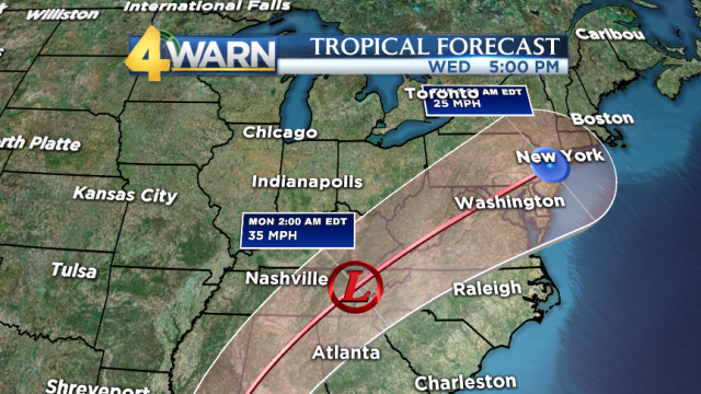
Nate is currently positioned just east off the the Honduras coast, bringing life-threatening flash flooding and mudslides to the area. Maximum sustained winds are 45 mph and the system as a whole is moving at a decent pace NNW at 14 mph. 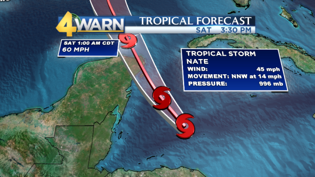
Nate will tred through the warm Gulf waters into the weekend which will fuel the storm enough to reach a category one hurricane status just before making landfall off the coast of Luosiana around New Orleans Saturday overnight into Sunday morning.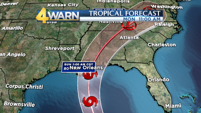
We’ll be next in the running but by this point, land interaction will weaken Nate significantly.
What you can expect:
Main timeline for rain and thunderstorms: Saturday night into Sunday.Since it’s a fast moving system and we have not had a decent rain event in weeks, widespread flash flooding is not a concern. However, heavy downpours may lead to localized flooding. The greatest timeline for severe weather is expected to be Sunday afternoon into the early evening. Scattered rain and storms carry on into Monday and Tuesday as well.
This is a forecast you’ll want to stay tuned with updates!
Meteorologist Paul Heggen will have the latest track on News 4 at noon and Chief Meteorologist Lisa Spencer has you covered at 4, 5, 6 and 10 tonight!
-Meteorologist Daphne DeLoren
