
WEATHER
A good chance of rain showers will be moving in from the west over the next 24 hours. Temperatures will only reach the upper 40s thanks to the cloud cover and scattered showers:

The best chance of rain today will be along and north of I-40, then the best chance of rain tonight will be along and south of I-40. That’s a generalization — as the HRRR model’s radar simulation shows, a few showers will creep onto the “other” side of that I-40 dividing line today, before fully shifting southward (the loop goes through 11pm):

We’ll let the RPM model pick things up from there as the rain slowly diminishes from north-to-south overnight:


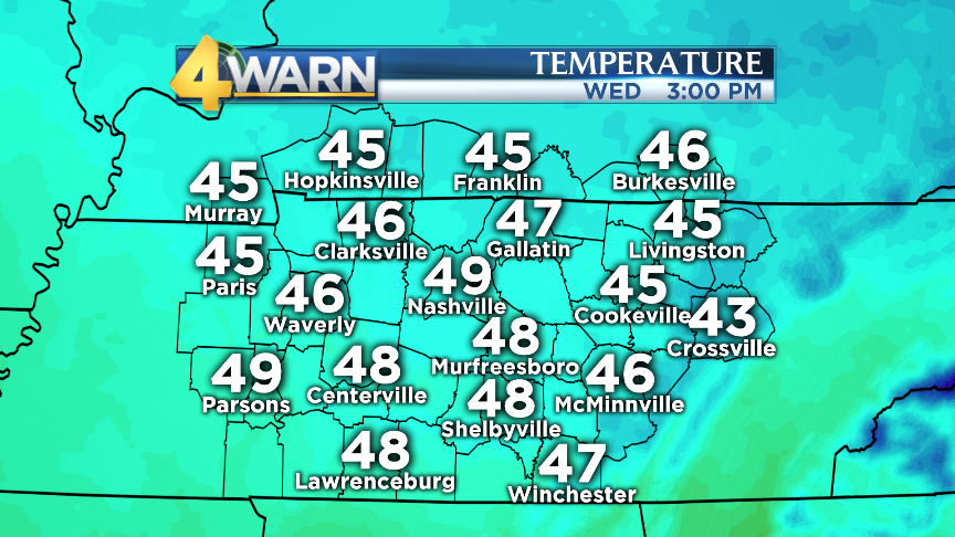
The showers should be gone by early Wednesday morning, leaving us with decreasing clouds and highs near 50°:
After a cold start Thursday morning, a big warm-up will kick in — highs Thursday will reach the mid 50s, then we’ll be well into the 60s Friday:

The warm spell continues into the holiday weekend:

Some showers are possible on Saturday — the European forecast model is pretty impressed with our rain chances, while all of the other long-range data is significantly drier. The Euro is the more accurate model in general, but it’s an outlier for now…so just be flexible with any outdoor plans on Saturday, and we’ll keep you posted as the rain chances (hopefully) come into better focus.
LINKS
- The big national story is the evacuation of thousands of people in California as the Oroville Dam spillway is in danger of failing.
- Satellite images reveal how swollen California’s rivers have grown.
- Has this year’s record rain finally ended California’s epic drought? Not really.
- Everything is back online now, but yesterday the National Weather Service suffered a “catastrophic” outage — NWS websites stopped sending forecasts and warnings.
- With La Niña gone, meteorologists are looking toward the next El Niño.
- Even with a snowy break for the northeastern U.S. in the past week, the heat is on across most of the country this winter. If winter ended today (spoiler: it doesn’t) this would be the 6th-warmest winter (Dec-Jan-Feb) on record in Nashville.
- This is disheartening: not even the world’s deepest ocean trenches are free of pollution.
- NASA scientists head to Mt. Erebus in Antarctica to test technology that could one day help us understand icy worlds beyond Earth.
- Proxima Centauri-b (our nearest planet in the “Goldilocks zone” around its star) and most other exo-planets are likely uninhabitable.
- Astronomers are getting an unprecedented look into the aftermath of an exploding star.
- Faintest galaxies ever seen explain the “missing link” in the universe.
- It’s hard to take a good picture of the night sky, especially with a phone camera. Here are some tips on how to get better nighttime photos.
- IMPORTANT SCIENCE ALERT: Best way to get ketchup out of a bottle? First, understand how non-Newtonian liquids behave.
- The promos for Netflix’s “Iron Fist” series have been everywhere on social media, so here’s a scientific question: How much punch does Iron Fist pack?
